|
Hiking |
|
|
Apricale is located in
the middle of a wonderful area for walkers. From easy strolls to
half-day or demanding whole day hikes to multi day trekking.
|
|
|
The easiest way to
have a short introduction to Apricale, between 1 and 2 hours,
takes you around a circle walk mainly on small roads. Starting
on the “provincial” road down towards Isolabona, we take the
road on the right toward the restaurant “La Favorita” and we
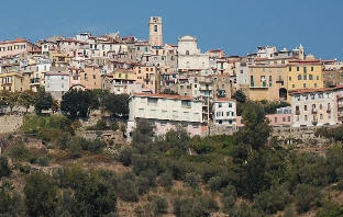
continue walking on the panoramic road, from where we can admire
the village of Apricale from above with wooded hillsides behind.
In spring, orchids and many other Mediterranean flowers blossom.
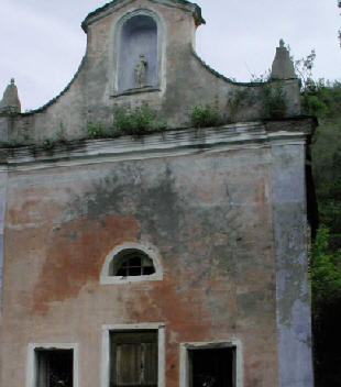
At S. Rocco church there is a way back down to the top part of
the village along a narrow footpath. Alternatively continue on
to the Apricale/Bajardo main road where a right turn takes you
back towards Apricale. The next right we can take we arrive at
the cemetery and to Via Cavour, then on to the main piazza.
Whereas, if we keep walking straight on, we get to the Tarocchi
bar in the lower part of the village. This walk can also be done
in the opposite direction. |
 |
|
A
hike that follows the old mule trails, which is quite demanding
(about a 300 m climb) and takes us up to Perinaldo. Just below
the chemist in Apricale, on the left, is the footpath (signposted
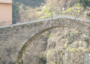
in red and white) which goes down into the valley to the ruins
of an old olive mill and the Roman stone bridge that crosses the
Merdanzo river. After the bridge we take the wide mule track
toward Perinaldo, after about one hour and a half hours of a
steep climb through the woods, we get to the outside of
Perinaldo and great views back down to Apricale. In Perinaldo,
Gaggian bar offers a gorgeous view down to the sea and welcome
refreshments. An alternative way is to go left from the mule
track after about 20 mins from the bridge to a church which is
set in a flat area with large chestnut trees. Go left from the
church to an access road which takes you to the Apricale to
Perinaldo road, go right and you will be in Perinaldo in 30 mins.
This route can be combined with the direct path for a good half
day circular hike. |
 |
|
An easy outing
but for which you need a car, takes us, after about a one hour
drive, to Mount Ceppo, after Bajardo. At Ghimbegna pass, we turn
left toward Mount Ceppo-Langan. Once we get to Mount Ceppo there
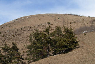
is a large parking and a pic nic area. Here, we take the
footpath which takes us in about 40 minutes to the top, at 1627
m, from where you can enjoy an incredible view towards the
Ligurian Alps, French Alps, the sea and the “riviera” towns (in
particularly clear days you can also see Corsica).
Another walk
starting from Bajardo is the Balcony Path to Perinaldo along the
ridge of the mountain past M. Bignone. This is a beautiful path
but is too far in one day in from Apricale, unless you want to
use 2 cars. A simpler way to do part of this walk is to drive
from Apricale to Perinaldo and on towards San Romolo, where
before the tunnel on the ridge there is a parking and where the
footpath starts. |
 |
|
A
favourite place of many people is Rio Barbaira, near Rocchetta
Nervina (only 9 Km from Apricale). In the imposing canyons of
steep rocks over 100 m high in summer it’s possible to bathe in
the fresh pools of Barbaira river. From here, several long
footpaths take us up to Gouta’s gorge passing Ponte Pau, Monte
Abellio or from Monte Morgi to Isolabona. Rochetta is the
starting point of the multi day Alta Via high Way route. On the
way back to Rocchetta, I recommend a stop at Ristorante
Gentile, where you’ll find fine fish dishes of Ligurian cuisine.
|
 |
|
Here are some other interesting proposals: |
|
|
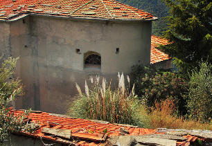
Pigna awaits for you with its way of the small chapels walk to
Chiesa della Madonna di Passoscio, also called Annunziata.
You start from the centre of Pigna (280 m s/m ) towards the
North, after a stone church, and segment of cemented road, you
follow Via Crucis until the destination (670 m s/m), in a
three-hours walk. This route will also take you up to the Alta
Via and various day circular walks or multi day hiking
possibilities.
|
 |
|
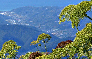
From Colle Melosa
1540m (about
1 hour
drive from
Apricale)
paths
lead you to the
‘little dolomites’, Mount
Pietravecchia and Toraggio 2038
m. A hard
6-7 hours
of walking and
495 m
altitude
change will take you around these mountains passing the French
and Italian slopes back to your car in Colle Melosa. There is
also a high quality mountain refuge here if you want to prolong
your stay in the mountains.
|
 |
|
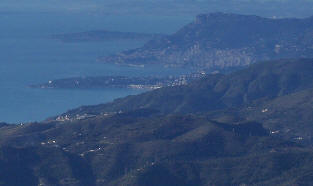
Monte
Bignone. |
 |
|
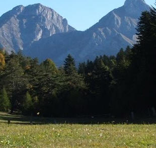
From Gouta (which is
approx. 1
hour drive
from Apricale) a
left turn before Pigna you can
hike to
the Head
of the
Alps with fantastic views down to the sea in
5 hours,
or walk to Torragio
from the opposite side as from Colle Melosa.
|
 |
|
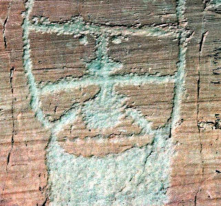
In Val Roya a trip to St. Dalmas de Tende from
where you turn left up to the Valley of Marvels with its thousands
of prehistoric rock drawing. Casterino in winter, offers cross-country
skiing, snowshoeing and sleigh rides with dogs. A trip that
would require qt least one overnight stay form Apricale. |
 |
|
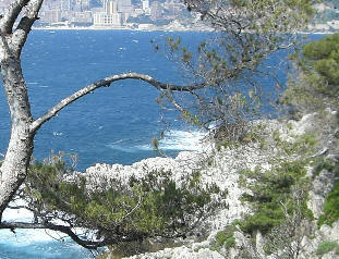
Le Corbusier
path encircling Cap Martin is
a flat
comfortable walk along
the sea
passing prestigious villas
and gardens with
views of Monaco. 2-3
hours. Starting from the edge of Menton.
|
 |
|
As you
can see, Apricale can be
a starting point for
many different types of hikes for all ages and abilities.
More info
Weekly schedule of day or half day hikes
throughout the region on Thursdays through the spring, summer
and autumn with naturalistic guide Diego Rossi.
See
http://www.crestediconfine.com/ for
program ( in Italian) and lots of beautiful photos.
Robert West ( resident English contact for
suggested itineraries, hiking maps and organiser of group walks)
e.mail :
rjc.west@gmail.com
skype : robert-west
tel: 3478547979
Gerd Nieschalk
( Part time German resident contact with lots of walking
experience in the area)
e.mail: genie.1a@web.de
tel. 0049
151 152 675 82 |
|